

Collection: Osher Map Library Collection
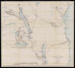
Name: A map of a portion of central Africa by Dr. Livingstone from his own surveys, drawings, and observations between the years 1866 and 1873
Barcode:
Image Number:
Publisher:
Date/Date Range Produced:
Date/Date Range Published:
Language:
Dimensions: 72 x 82 cm
Notes: From "The last journals of David Livingstone, in Central Africa" [OML-1875-57]
Brief Description: "Dr. Livingstone's routes from March 24th 1866 to May 1st 1873 are coloured red."
LC Call Number: G8630 1875.H3
OCLC: 1004273964
Accession Number: OML-1875-62
Permanent URL: